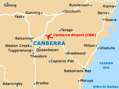
Canberra Airport (CBR)
City Orientation and Maps
(Canberra, Australian Capital Territory (ACT), Australia)
The city of Canberra lies close to the south-eastern coast of Australia, to the south-west of Sydney and the north-east of Melbourne. Other prominent locations close to Canberra include Batemans Bay and Ulladulla to the east, Goulburn, Dickson, Downer and Belconnen to the north, Stromlo, Wagga Wagga and Tumut to the west, and Tuggeranong, Wooden Valley and Jerrabomberra directly south. Canberra Airport (CBR) is sited on the south-eastern side of the city and can be reached in around 15 minutes.
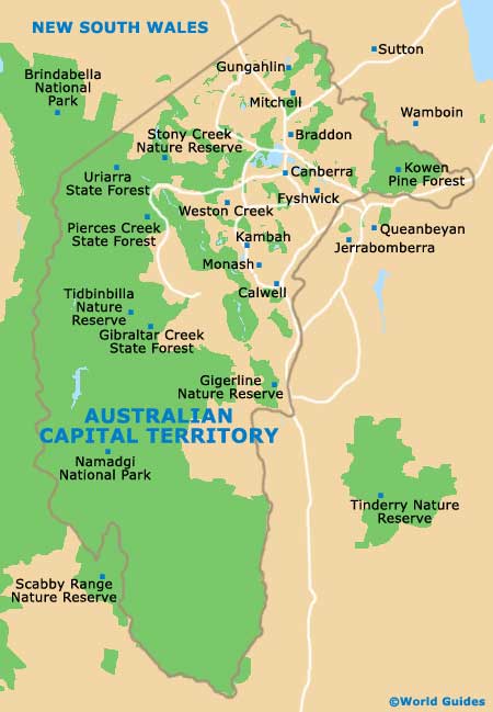
Canberra is centred around Lake Burley Griffin which provides scenic views from many parts of the city. From the northern side of the city, Northbourne Avenue runs directly into the heart of the city from the Federal Highway and beyond.
Canberra Airport (CBR) Maps: Important City Districts
On the southern side of the city, Northbourne Avenue leads onto Commonwealth Avenue and stretches to the Capital Circle, surrounding the famous Parliament House. Many important buildings reside in this part of Canberra, such as the Old Parliament House, the National Gallery of Australia and the High Court of Australia.
Other notable areas of Canberra include Chinatown and Dickson - located around Woolley Street, the North Canberra district - including both the Lyneham and Turner neighbourhoods, South Canberra - known for its shops, restaurants and relaxed attitude, and Tuggeranong - home to the popular Tidbinbilla Nature Reserve and a number of excellent trails. For those looking for entertainment and nightlife, head to the Woden Town district, where you will find many impressive live music venues and clubs.
Australia Map

Australian Capital Territory Map
Canberra Map